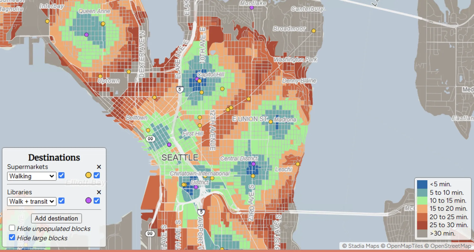
This article discusses the creation and impact of “Close,” an interactive map designed by geographer Nat Henry. The map allows users across the U.S. to explore neighborhood walkability and access to essential destinations such as grocery stores, parks, and schools. Initially a Seattle-focused project, it has expanded nationwide, helping individuals and policymakers make more informed decisions about housing, urban planning, and accessibility.


